博文
哥伦布凭什么发现新大陆?
|||
以下是被认为一幅哥伦布航行的依据。他还未出航,地图已经在。原文说,哥伦布的依据的地图是“外星人”作的(alien可译为外方人,其实是中国人)。

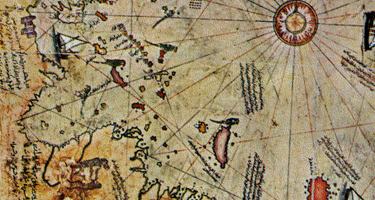
原文附图(下面有比较清晰的地图)
When Christopher Columbus crossed the Atlantic Ocean 517years ago, he used a map of the New World that could only have been prepared by aliens!
“The original map that Columbus used in 1492 has long since disappeared but a copy of it that was made in 1513 still survives and has intrigued historians and cartographers since its discovery in Istanbul 80 years ago,” declares Turkish researcher Mehmet Ali Yilmaz.
“It’s an incredibly detailed chart,” he continues, “showing many important geographic landmarks which hadn’t even been discovered in 1513 –like the Andes Mountains, the course of the Amazon River and Antarctica. It shows the southern tip of Florida, portions of Mexico and all of the Caribbean islands, Central America and South America.
“But the most incredible thing about this chart is that mathematical analysis shows it is an aerial view of the southern hemisphere taken from many miles above Earth, clearly showing the curvature and proving the world wasn’t flat.
“This copy of the Columbus map was foundin 1929 by a museum official in Istanbul,” the researcher adds.
“It was painted on parchment by a 16th century Turkish admiral and mapmaker, Piri Re’is.
“In a note in the margin, Piri Re’is stated that he had consulted ‘about 20′ charts in compiling his map – including one which Columbus had taken with him on his 1492 voyage.”
After years of being ignored by professional geographers, itwas an American college professor, Charles Hapgood, who finally recognized the significance of the Piri Re’is chart in the early 1960s.
“After analyzing it mathematically,” Ali Yilmaz says,“Hapgood determined it could only be an aerial view whose projection point was miles above the meridian of the Egyptian city of Alexandria, the site of an ancient library.
“And when he uncovered similar ancient maps, Professor Hapgood concluded that the original maps were made by space travelers and were then copied by scholars at the centuries-old library.”
But how did one of the maps fall into Columbus’ hands?
“Where he got it isn’t important,” the researcher says.“It’s where the map got him.”
http://weeklyworldnews.com/alien-alert/12560/christopher-columbus-map/
==========
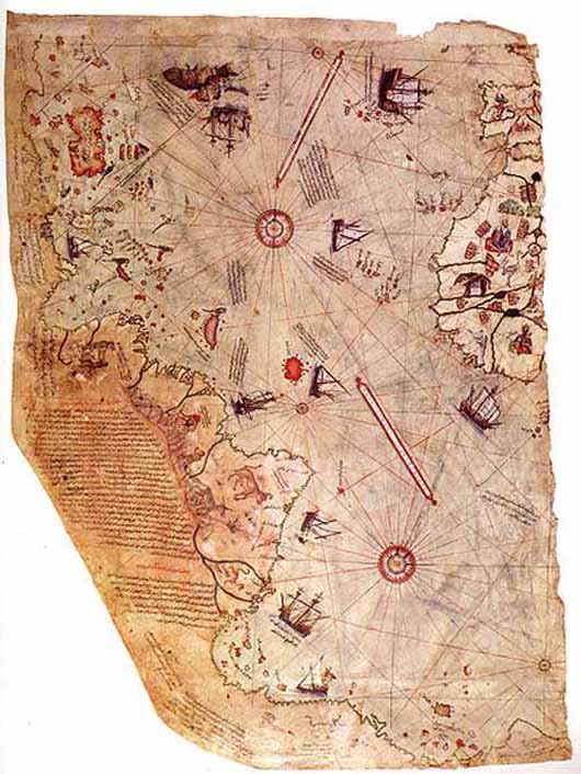
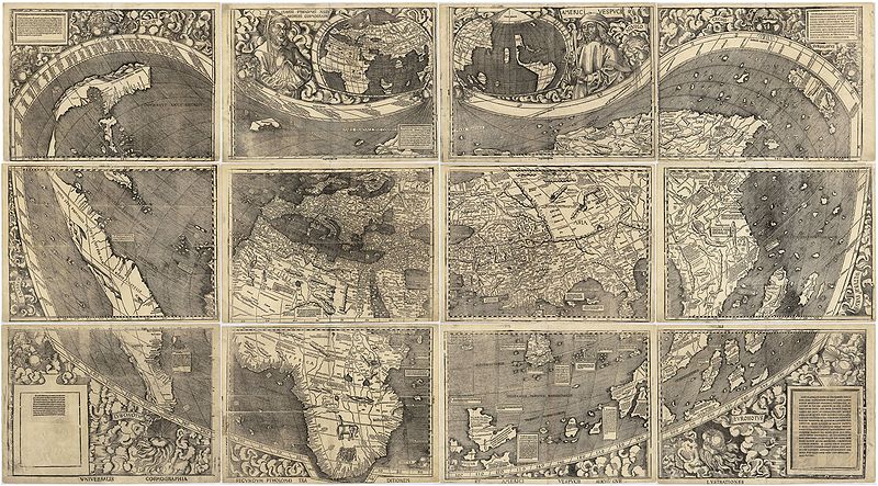
以下是另一网站提供的地图。这地图可以与Waldseemueller 1507年地图比较,后者连“太平洋”(中国称沧溟宗)也有了,欧洲人还没有“发现”。

Surviving fragment of the first World Map of Piri Reis (1513)
这种地图叫Portolan 地图。 想想,海洋中心的两个圆心有什么意义,如何制定它的经纬度?
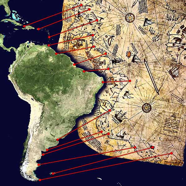
下面与现代地图比较:

Comparison between a modern projection of South America and Piri Reis's version.
http://www.crystalinks.com/pirireis.html
 Waldseemueller 1507年世界地图 (太平洋还未被欧洲人“发现”,西班牙人Balboa 1513年才到达巴拿马的太平洋一边)
李兆良 2016.3.29
https://blog.sciencenet.cn/blog-1674084-965888.html
上一篇:南京郑和墓展厅宣示:明代到达美洲澳洲
下一篇:从教学科研到更正世界史-向科学网进言